Trail Closures: Several trails are closed due to the July flooding event. To check the status of a trail, visit Trailfinder.info.
Hiking Overview
Vermont State Parks offer a wide variety of hiking opportunities. Whether you're looking for an easy, family friendly hike or looking for outstanding views from a summit hike, or something in between, there is a trail nearby waiting for you.
See our list of hiking trails for some ideas, then go get more information from one of our maps or hiking guides. Grab your pack and a picnic lunch and hit the trail.
Hiking Trails
Click the buttons to view specific descriptions, including trail length, difficulty, estimated hiking time, and kid-friendliness. Printable PDF trail maps are also provided.
Northwest:
Burton Island, Knight Island, Knight Point, Lake Carmi, Niquette Bay, Underhill, Woods Island
Burton Island State Park
Park map and guide (PDF) and park trails on Trailfinder
| Trail Name | Mileage | Loop or One Way | Difficulty | Hiking Time | Description | Kid-Friendly |
|---|---|---|---|---|---|---|
| West Shore Trail | 0.75 | One way or loop to other trails | Easy | 1 hour | Woodland, Lakeside | |
| North Shore Trail (PDF) | 0.50 | One way or loop with Eagle Bay Trail | Easy | 30 min | Woodland, Lakeside | |
| Eagle Bay Trail | 0.50 | One way or loop with North Shore Trail | Easy | 30 min | Woodland, Lakeside | |
| Island Farm Nature Trail (PDF) | 1.00 | Loop | Easy | 1 hour | Woodland, Meadow | |
| Southern Tip Trail | 1.00 | One way | Easy | 1.5 hours | Woodland, Meadow, View |
Knight Island State Park
| Trail Name | Mileage | Loop or One Way | Difficulty | Hiking Time | Description | Kid-Friendly |
|---|---|---|---|---|---|---|
| West Trail | 1.00 | Loop when combined with East or Cross Trails | Easy | 1 hour | Woodland, Lakeside | |
| East Trail | 1.00 | Loop when combined with West or Cross Trails | Easy | 1 hour | Woodland, Lakeside, Views | |
| Cross Trail | 0.50 | Connector Trail | Easy | 30 min | Woodland |
Knight Point State Park
Park map and guide (PDF) and park trails on Trailfinder
| Trail Name | Mileage | Loop or One Way | Difficulty | Hiking Time | Description | Kid-Friendly |
|---|---|---|---|---|---|---|
| Point Trail | 1.00 | One way or loop through park | Easy | 30 min | Woodland, Lakeside |
Lake Carmi State Park
Park map and guide (PDF) and park trails on Trailfinder
| Trail Name | Mileage | Loop or One Way | Difficulty | Hiking Time | Description | Kid-Friendly |
|---|---|---|---|---|---|---|
| Marsh Brook Nature Trail | 1.50 | Loop | Moderate | 1.5 hours | Woodland, Meadow, Lakeside |
Niquette Bay State Park
Park map and guide (PDF) and park trails on Trailfinder
| Trail Name | Mileage | Loop or One Way | Difficulty | Hiking Time | Description | Kid-Friendly |
|---|---|---|---|---|---|---|
| Mulhley Trail | 1.30 | One way or loop with other trails | Moderate | 45 mins | Woodland, Views | |
| Burns Trail | 1.00 | One way or loop with other trails | Easy | 20 mins | Woodland, Views | |
| Allen Trail | 0.50 | One way or loop with other trails | Easy | 15 mins | Woodland | |
| Ledges Trail | 0.90 | One way or loop with other trails | Moderate | 30 mins | Woodland, Views | |
| Island View | 0.25 | Loop | Moderate | 15 mins | Woodland, Views |
Underhill State Park
Park hiking trails (PDF) and park trails on Trailfinder
| Trail Name | Mileage | Loop or One Way | Difficulty | Hiking Time | Description | Kid-Friendly |
|---|---|---|---|---|---|---|
| CCC Road to Sunset Ridge | 1.00 | One way | Easy | 1 hour | Woodland | |
| Cantilever Rock Trail | 0.90 | One way | Moderate | 1 hour | Woodland, Cliffs, Views | |
| Sunset Ridge Trail to Chin | 2.30 | One way | Difficult | 2.5 hours | Woodland, Cliffs, Views | |
| Laura Cowles to Chin | 1.70 | One way | Very difficult | 2.5 hours | Woodland, Cliffs, Views | |
| Halfway House to Nose | 1.50 | One Way | Difficult | 2 hours | Woodland, Cliffs, Views | |
| CCC Road to Maple Ridge Trail | 1.10 | One Way | Moderate | 1 hour | Woodland, Cliffs, Views | |
| Maple Ridge to Nose | 2.10 | One Way | Difficult | 3 hours | Woodland, Cliffs, Views | |
| Long Trail Nose to Chin | 1.20 | One Way | Moderate | 1.5 hours | Cliffs, Views |
Woods Island State Park
| Trail Name | Mileage | Loop or One Way | Difficulty | Hiking Time | Description | Kid-Friendly |
|---|---|---|---|---|---|---|
| Island Loop | 2.00 | Loop | Easy | 2 hours | Woodland, Lakeside | |
| Cross Trail | 0.50 | One way, Connector | Easy | 30 min | Woodland |
Northeast:
Brighton, Elmore, Kettle Pond, New Discovery, Ricker Pond, Little River, Seyon Lodge, Smugglers' Notch, Waterbury Center
Brighton State Park
Northeast Kingdom Nature Trail (PDF)
| Trail Name | Mileage | Loop or One Way | Difficulty | Hiking Time | Description | Kid-Friendly |
|---|---|---|---|---|---|---|
| Red Pine Trail | 0.33 | Loop with Main or Shore Trail | Easy | 20 min | Woodland | |
| Main Trail | 0.50 | Loop with Red Pine or Shore Trail | Easy | 45 min | Woodland | |
| Logger's Loop | 0.25 | Loop | Easy | 15 min | Woodland | |
| Shore Trail | 0.40 | Loop with Red Pine or Main Trail | Easy | 20 min | Woodland, Lakeside |
Elmore State Park
| Trail Name | Mileage | Loop or One Way | Difficulty | Hiking Time | Description | Kid-Friendly |
|---|---|---|---|---|---|---|
| Mountain Brook Nature Trail (PDF) | 0.50 | One Way | Easy | 20 min | Woodland, Wetland | |
| Fire Tower Trail | 1.74 | Loop with Ridge Trail | Moderate to difficult | 1.5 hours | Woodland, Firetower, Views | |
| Ridge Trail | 2.3 | Loop with Fire Tower Trail | Moderate to difficult | 2.25 hours | Woodland, Firetower, Views |
Groton Forest Trails - Kettle Pond State Park
Park map and guide (PDF) and Groton State Forest trails on Trailfinder
| Trail Name | Mileage | Loop or One Way | Difficulty | Hiking Time | Description | Kid-Friendly |
|---|---|---|---|---|---|---|
| Kettle Pond Trail | 3.00 | Loop | Easy | 2.5 hours | Woodland, Lakeside | |
| Kettle Pond Portage Trail | 0.25 | One Way | Easy | 20 mins. | Woodland, Lakeside |
Groton Forest Trails - New Discovery State Park
Groton State Forest summer trails map and guide (PDF) and Groton State Forest trails on Trailfinder
| Trail Name | Mileage | Loop or One Way | Difficulty | Hiking Time | Description | Kid-Friendly |
|---|---|---|---|---|---|---|
| New Discovery to Osmore Pond | 0.50 | One Way | Easy | 30 min | Woodland, Lakeside | |
| Osmore Pond Hiking Loop | 2.00 | Loop | Easy | 2 hours | Woodland, Lakeside | |
| Little Deer Trail | 0.50 | One Way | Moderate | 30 min | Woodland, Views | |
| Big Deer Mtn Trail | 0.90 | One Way | Moderate | 45 min | Woodland, Views | |
| Hosmer Brook Trail | 1.30 | One Way | Moderate | 1 hour | Woodland, Stream | |
| Nature Trail | 0.60 | One Way | Easy | 45 min | Woodland | |
| Coldwater Brook | 1.90 | One Way | Moderate | 2 hours | Woodland | |
| Owl's Head | 1.50 | One Way | Easy | 1 hour | Woodland, Views | |
| Peacham Bog | 4.50 | Loop | Moderate | 3.5 hours | Woodland, Bog | |
| Silver Ledge Trail | 0.60 | One Way | Moderate to difficult | 30 min | Woodland, Views | |
| Peacham Bog Nordic Trail | 5.00 | One Way | Moderate | 1.5 hours | Woodland, Bog |
Groton Forest Trails - Ricker Pond State Park
| Trail Name | Mileage | Loop or One Way | Difficulty | Hiking Time | Description | Kid-Friendly |
|---|---|---|---|---|---|---|
| Cross Vermont Trail | 10.00 | One Way | Easy | Rail trail, Woodland |
Little River State Park
Little River trails guide and map (PDF)
| Trail Name | Mileage | Loop or One Way | Difficulty | Hiking Time | Description | Kid-Friendly |
|---|---|---|---|---|---|---|
| Nature Trail (PDF) | 0.50 | Loop | Easy | 45 min | Woodland, Stream | |
| Dalley Loop Trail | 3.55 | Loop | Moderate | 3 hours | Woodland, Stream | |
| Stevenson Brook Trail | 2.50 | One way or loop with other trails | Moderate | 1.5 hours | Woodland, Stream | |
| Sawmill Trail | 0.55 | One Way | Moderate to difficult | 45 min | Woodland, Stream | |
| Hedgehog Hill Trail | 1.30 | One Way | Moderate | 2 hours | Woodland | |
| Ricker Farm Trail | 1.21 | One Way | Moderate | 1 hour | Woodland | |
| Kelty Corners Trail | 0.56 | One Way | Moderate | 45 min | Woodland | |
| Foster's Trail | 1.4 | One Way | Moderate | 1 hour | Woodland | |
| Cotton Brook Road Multi-Use | 6.47 | One Way | Moderate | 7 hours | Woodland, Stream |
Seyon Lodge State Park
| Trail Name | Mileage | Loop or One Way | Difficulty | Hiking Time | Description | Kid-Friendly |
|---|---|---|---|---|---|---|
| Noyes Pond Loop | 1.00 | Loop | Easy | 1 hour | Woodland, Lakeside |
Smugglers' Notch State Park
Smugglers' Notch trail map and guide (PDF) and Smugglers' Notch trails on Trailfinder
| Trail Name | Mileage | Loop or One Way | Difficulty | Hiking Time | Description | Kid-Friendly |
|---|---|---|---|---|---|---|
| Sterling Pond Trail | 1.1 | One Way | Moderate to difficult | 1 hour | Woodland, Lakeside | |
| Hell Brook to Chin | 1.80 | One Way | Difficult | 2 hours | Woodland, Mountain | |
| Long Trail N. to Sterling Pond | 3.00 | One Way | Difficult | 2 hours | Woodland, Mountain | |
| Long Trail S. to Chin | 2.7 | One Way | Difficult | 3 hours | Woodland, Mountain | |
| Long Trail Nose to Chin | 1.20 | One Way | Moderate | 1 hour | Woodland, Mountain, Views | |
| Haselton to Mt. Mansfield Nose | 2.3d | One Way | Moderate | 2 hours | Woodland, Mountain, Views | |
| Bingham Falls | 0.3 | One Way | Easy | 1 hour | Woodland, Waterfall |
Waterbury Center State Park
| Trail Name | Mileage | Loop or One Way | Difficulty | Hiking Time | Description | Kid-Friendly |
|---|---|---|---|---|---|---|
| Peninsula Trail (PDF) | 0.50 | Loop | Easy | 15 min | Woodland, Lakeside |
Southwest:
Bomoseen, Branbury, Button Bay, Emerald Lake, Half Moon Pond, Lake Shaftsbury, Lake St. Catherine, Mt. Philo, Woodford
Bomoseen State Park
Park hiking trails (PDF) and park trails on Trailfinder
| Trail Name | Mileage | Loop or One Way | Difficulty | Hiking Time | Description | Kid-Friendly |
|---|---|---|---|---|---|---|
| Bomoseen Hiking Loop | 1.50 | Loop | Moderate | 1 hour | Woodland, Pond | |
| Slate History Trail | 0.75 | One Way | Easy | 1 hour | Woodland, Slate | |
| Glen Lake Trail | 4.50 | One Way | Moderate | 4 hours | Woodland, Lakeside, Views | |
| Daniel Coffey Memorial Trail | 0.75 | One Way | Easy | 1 hour | Woodland, Pond |
Branbury State Park
Park hiking trails (PDF) and park trails on Trailfinder
| Trail Name | Mileage | Loop or One Way | Difficulty | Hiking Time | Description | Kid-Friendly |
|---|---|---|---|---|---|---|
| Nature Trail | 0.50 | Loop | Easy | 45 min | Woodland | |
| Rattlesnake Point | 1.50 | One Way | Moderate to difficult | 3-4 hours | Woodland, Views | |
| Falls of Lana | 1.00 | One Way | Easy | 45 min | Woodland, Waterfalls | |
| Silver Lake | 1.60 | Loop | Moderate | 2 hours | Woodland, Lakeside | |
| Mt. Moosalamoo Campground Trail | 6.80 | Loop | Moderate to difficult | 5-6 hours | Woodland, Brooks |
Button Bay State Park
Park map and guide (PDF) and park trails on Trailfinder
| Trail Name | Mileage | Loop or One Way | Difficulty | Hiking Time | Description | Kid-Friendly |
|---|---|---|---|---|---|---|
| Button Bay Point Trail | 0.30 | Loop | Easy | 15 min | Lakeside | |
| Dog Walk Trail | 0.25 | One Way | Easy | 15 min | Open, Lakeside |
Emerald Lake State Park
| Trail Name | Mileage | Loop or One Way | Difficulty | Hiking Time | Description | Kid-Friendly |
|---|---|---|---|---|---|---|
| Vista Trail | 0.75 | One Way | Moderate | 1 hour | Woodland, Lakeside |
Half Moon Pond State Park
Park hiking trails (PDF) and park trails on Trailfinder
| Trail Name | Mileage | Loop or One Way | Difficulty | Hiking Time | Description | Kid-Friendly |
|---|---|---|---|---|---|---|
| Glen Lake Trail | 4.50 | One Way | Moderate | 1 hour | Woodland, Lakeside, Views | |
| Shore Trail | 0.30 | One Way | Easy | 20 min | Lakeside | |
| Daniel Coffee Memorial Trail | 0.75 | One Way | Easy | 1 hour | Woodland, Pond |
Lake Shaftsbury State Park
Park map and guide (PDF) and park trails on Trailfinder
| Trail Name | Mileage | Loop or One Way | Difficulty | Hiking Time | Description | Kid-Friendly |
|---|---|---|---|---|---|---|
| Healing Springs Nature Trail (PDF) | 0.75 | Round Trip | Easy | 1 hour | Lakeside, Woodland, Wetland |
Lake St. Catherine State Park
Park map and guide (PDF) and park trails on Trailfinder
| Trail Name | Mileage | Loop or One Way | Difficulty | Hiking Time | Description | Kid-Friendly |
|---|---|---|---|---|---|---|
| Nature Trail | 0.50 | Loop | Easy | 45 min | Woodland, Meadow, Stream |
Mt. Philo State Park
Park map and guide (PDF) and park trails on Trailfinder
| Trail Name | Mileage | Loop or One Way | Difficulty | Hiking Time | Description | Kid-Friendly |
|---|---|---|---|---|---|---|
| Summit Trail | 1.00 | One Way to Summit Trails | Moderate | 1 hour | Woodland, Summit | |
| Devil's Chair | 0.50 | One Way to Summit Trails | Moderate | 45 min | Woodland, Summit |
Woodford State Park
Park hiking trails (PDF) and park trails on Trailfinder
| Trail Name | Mileage | Loop or One Way | Difficulty | Hiking Time | Description | Kid-Friendly |
|---|---|---|---|---|---|---|
| Atwood Trail | 0.50 | Loop | Easy | 30 min | Woodland, Lakeside | |
| Reservoir Trail | 2.70 | Loop | Easy | Woodland, Lakeside |
Southeast:
Allis, Camp Plymouth, Fort Dummer, Gifford Woods, Jamaica, Lowell Lake, Molly Stark, Mt. Ascutney, Quechee, Townshend, Wilgus
Allis State Park
| Trail Name | Mileage | Loop or One Way | Difficulty | Hiking Time | Description | Kid-Friendly |
|---|---|---|---|---|---|---|
| Bear Hill Nature Trail (PDF) | 0.75 | Loop | Moderate to difficult | 1 hour | Woodland |
Camp Plymouth State Park
Park map and guide (PDF) and park trails on Trailfinder
| Trail Name | Mileage | Loop or One Way | Difficulty | Hiking Time | Description | Kid-Friendly |
|---|---|---|---|---|---|---|
| Echo Lake Vista | 1.00 | Round Trip | Moderate | 40 min - 1 hour | Woodland, Lake View |
Fort Dummer State Park
Park hiking trails (PDF) and park trails on Trailfinder
| Trail Name | Mileage | Loop or One Way | Difficulty | Hiking Time | Description | Kid-Friendly |
|---|---|---|---|---|---|---|
| Sunrise Trail | 1.00 | Loop | Easy | 45 min | Woodland, Views | |
| Sunset Trail | 0.50 | One Way | Easy | 25 min | Woodland, Views |
Gifford Woods State Park
| Trail Name | Mileage | Loop or One Way | Difficulty | Hiking Time | Description | Kid-Friendly |
|---|---|---|---|---|---|---|
| Old Growth Interpretive Trail | 0.10 | Loop | Easy | 10-15 min | Woodland | |
| Kent Brook Trail | 1.10 | Loop | Easy to moderate | 45 min | Woodland | |
| Appalachian Trail | Moderate to difficult | Woodland | ||||
| Pond and Waterfall Loop | 3.50 | Loop | Easy | 2.5 hours | Woodland, Brooks, Pools | |
| Deer Leap Overlook | 4.00 | Round Trip | Moderate | 2.5 hours | Woodland, Views |
Jamaica State Park
Park hiking trails (PDF) and park trails on Trailfinder
| Trail Name | Mileage | Loop or One Way | Difficulty | Hiking Time | Description | Kid-Friendly |
|---|---|---|---|---|---|---|
| West River Trail | 2.50 | One Way | Easy | 2.5 hours | Woodland, Riverside | |
| Overlook Trail | 2.00 | One Way | Moderate | 2 hours | Woodland, Views | |
| Hamilton Falls Trail | 6.00 | Round Trip | Moderate to difficult | 4 hours | Woodland, Falls |
Lowell Lake State Park
Park map and guide (PDF) and park trails on Trailfinder
| Trail Name | Mileage | Loop or One Way | Difficulty | Hiking Time | Description | Kid-Friendly |
|---|---|---|---|---|---|---|
| Lowell Lake Trail | 3.00 | Loop | Easy | 2 hours | Woodland, Lakeside |
Molly Stark State Park
Park hiking trails (PDF) and park trails on Trailfinder
| Trail Name | Mileage | Loop or One Way | Difficulty | Hiking Time | Description | Kid-Friendly |
|---|---|---|---|---|---|---|
| Mt. Olga | 1.70 | Loop | Moderate | 1.5 hours | Woodland, Views, Firetower |
Mt. Ascutney State Park
Park map and guide (PDF) and park trails on Trailfinder
| Trail Name | Mileage | Loop or One Way | Difficulty | Hiking Time | Description | Kid-Friendly |
|---|---|---|---|---|---|---|
| Brownsville | 3.20 | One way to other parking area | Moderate to difficult | 3 hours | Woodland, Mountain, Views | |
| Futures | 4.60 | One way to other parking area | Moderate to difficult | 4 hours | Woodland, Mountain, Views | |
| Weathersfield | 2.90 | One way to other parking area | Moderate to difficult | 3 hours | Woodland, Mountain, Views | |
| Windsor | 2.70 | One way to other parking area | Difficult | 2-3 hours | Woodland, Mountain, Views | |
| Summit Trail | 1.40 | Round Trip | Moderate | 2 hours | Woodland, Mountain, Views |
Quechee State Park
Park hiking trails (PDF) and park trails on Trailfinder
| Trail Name | Mileage | Loop or One Way | Difficulty | Hiking Time | Description | Kid-Friendly |
|---|---|---|---|---|---|---|
| Quechee Gorge Trail | 1.00 | Round trip from bridge to bottom of gorge | Moderate | 1 hour | Woodland, Gorge | |
| 1.50 | Round trip from Visitor Center to bottom of gorge | Moderate | 1.5 hours | Woodland, Gorge | ||
| 1.50 | Round trip from bridge to Dewey's Pond | Moderate | 1 hour | Woodland, Falls | ||
| 2.00 | Round trip from Visitor Center to Dewey's Pond | Moderate | 1.5 hours | Woodland, Falls |
Townshend State Park
Park hiking trails (PDF) and park trails on Trailfinder
| Trail Name | Mileage | Loop or One Way | Difficulty | Hiking Time | Description | Kid-Friendly |
|---|---|---|---|---|---|---|
| Bald Mountain Trail | 2.75 | Round trip | Moderate to difficult | 3 hours | Woodland, Summit, Views |
Wilgus State Park
Park map and guide (PDF) and park trails on Trailfinder
| Trail Name | Mileage | Loop or One Way | Difficulty | Hiking Time | Description | Kid-Friendly |
|---|---|---|---|---|---|---|
| Pinnacle Trail | 1.00 | Loop | Moderate | 1 hour | Woodland, View |
Trail Recommendations
Vermont has many awesome trails for hikers of all ages and skill levels. Here are just a few our recommendations.
Branbury State Park
Located on the shores of Lake Dunmore, Branbury State Park abuts the 400,000 acre Green Mountain National Forest and the 20,000 acre Moosalamoo Recreation Area. There are over 70 miles of trails in this region of mountains and lakes traversing the western slopes of the Green Mountains.
Some popular trails are the “Falls of Lana” which leads to a series of cascading falls carved out of rock, “Rattlesnake Point”, which has breeding peregrine falcons and panoramic views of Lake Dunmore, and “Silver Lake”, a hike to a small, scenic mountain lake.
Camel's Hump
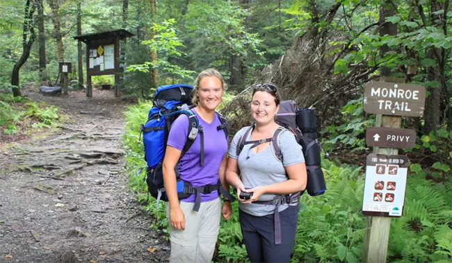
On the Duxbury side of Camel's Hump State Park, the Monroe Trail is somewhat challenging, but there's also a universally-accessible loop with its own parking area. This loop is 8/10 of a mile long, is wide and flat, and has three viewing spots to the summit of Camel's Hump - it's perfect for small kids and elders.
On the Huntington side, the Burrows Trail is a bit shorter and attracts lots of hikers. Always a good idea to get there early (8AM) on a good weather weekend day to get parked and on the trail.
All trails get more rugged as they get closer to the summit.
Gifford Woods State Park
Gifford Woods State Park is an important hiking crossroads where two major hiking trails meet. The Appalachian Trail, which runs from Georgia to Maine, and the Long Trail, which runs the length of Vermont meet in the park. If you were so inclined, you could literally hike from the park south to Georgia or north to Maine.
Nearby Green Mountain National Forest and Coolidge State Forest also offer numerous loop hikes. There are spectacular views from the Deer Leap Mountain trail and lovely waterfalls along Thundering Brook Trail. The proximity to all these great hiking opportunities make Gifford Woods State Park a popular pass through location for hikers.
Mt. Ascutney
We know today that Mount Ascutney is a monadnock and is not related geologically to surrounding hills. Rather, it stands alone and shares a geological history more closely with the White Mountains of New Hampshire. There are four trails that run from the base of the mountain to the summit that are connected by a relatively level trail that follows the ridgeline and crosses the summit. They are:
- The Weathersfield Trail. The trail runs 2.9 miles along the south face of the mountain, passing Cascade Falls, the largest waterfall on the mountain.
- The Windsor Trail. The trail runs 2.7 miles to the summit, passing a small waterfall and the remains of an old stone shelter.
- The Brownsville Trail. This trail is 3.2 miles and follows an old logging road, passing an old granite quary and offering great views from the north and west.
- The Futures Trail. This 4.6 mile trail is the longest on Mt. Ascutney. It can be accessed at two points along the state park mountain road.
The Mt. Ascutney Parkway is a 3.7 mile paved road leading to the summit, revealing many excellent scenic views. Additionally, there is a .7-mile side trail to an observation tower on the summit with a panoramic view of the surrounding countryside.
Mt. Mansfield East Side (Underhill State Park)
Underhill State Park is a part of Vermont’s 34,000-acre Mount Mansfield State Forest. The park is on the western face of Mt. Mansfield, nearly half way up the state’s highest peak.Over the summit ridge is the Stowe Mountain Resort, one of North America’s original ski areas.
From Underhill State Park there are four hiking trails to the summit ridge of Mt. Mansfield. The Sunset Ridge trail (3.2 miles to the summit) is the most popular.
Vermont’s Long Trail traverses the summit ridge and, with several trails up both sides of the mountain, many loops are possible. The ridgeline is almost entirely above tree line, so on clear days you have unobstructed views of the surrounding peaks and valleys, even to Lake Champlain in the distance, and New York’s Adirondack mountains far beyond.Mount Mansfield is one of the two spots in Vermont where you will find true alpine tundra, a vegetative type more common in arctic zones far to the north.
Mt. Mansfield West Side (Smugglers' Notch State Park)
On the other side of Mount Mansfield from Underhill State Park, lies Smugglers' Notch State Park. Smugglers' Notch is a narrow pass through the mountain with spectacular 1,000 foot cliffs on either side. The pass was once used as a smuggling route between Vermont and Canada. Today, it is a favorite haunt of nesting peregrine falcons, ice climbers and hikers.
The road is passable by vehicles only in summer and is very narrow and winding with many switchbacks and hairpin turns. The Notch is also a favorite of hikers.
The most popular trail up the mountain is the Long Trail, which can be accessed from the Notch. Heading north, the Long Trail leads past Elephant’s Head to Sterling Pond, a beautiful and serene mountain lake.
Hiking with Kids
People of all ages love to get outside and hike! Here is a listing of hikes all over the state that are good for kids and families.
Hiking with your Pet
Pets are permitted on trails unless otherwise posted. Here are some basic rules:
- Dogs must be on leash at all times on state park trails
- Pets are expected to have current rabies vaccination
- Please pick up after your pet
Hiking with Groups
If you are hiking with 10 or more people or charging fees, or publicizing the event, you will need to apply for a Special Use Permit.
Mud Season Hiking
Trail Updates & Closures
Mud Season Trail Conditions
VIEW TRAIL STATUS
What is mud season, anyway?
When the snow starts melting and the temperatures get warmer, most of us want to get outside and hike! But, mud season is not a good time for hiking in certain areas. Rain and melting snow at higher elevations are keeping many of Vermont's hiking trails wet and muddy. When hikers tramp on saturated soils, they cause soil compaction and erosion as well as damage to the trail and surrounding vegetation. Please help protect the fragile trails this time of year by staying off muddy trails.
Higher elevation soils take longer to dry out. And after heavy snowfall this winter and following spring rains, the trails will take longer than normal to dry out. A trail may be dry at the trailhead, but is muddy at a higher elevation this time of year. If you notice this happening, please turn around! Trails at lower elevations, dirt roads, and recreation paths provide excellent places for early spring walking.
Along with the warmer weather, there are many aspects of nature beginning to emerge for us to enjoy. Thank you for helping to preserve our beautiful natural resources!
Guidelines to follow when hiking this time of year
- If a trail is so muddy that you need to walk on the vegetation beside it, turn back and seek another place to hike.
- Plan spring hikes in hardwood forests at lower elevations.
- Avoid spruce-fir (conifer) forest at higher elevations and on north slopes before late May and from the end of October until frozen or snow covered.
- Camels Hump and Mt Mansfield trails are closed from April 15 through the Friday of Memorial Day Weekend. Please do not hike here. Stay below 3000 ft during these times of year.
Staying away from certain places during mud season makes them ready to enjoy this summer. Have fun out there!
For more information, and other mud season hiking options, check out the Dept. of Forests, Parks and Recreation's Mud Season page.
Mud Season Hike Recommendations
Below is a list of great places that we recommend generally for hiking during mud season, as well as some more detailed information about this time of year.
Southeast Vermont
- Mt. Ascutney State Park Parkway (PDF) (after mid April, when the ice has melted)
- Myron Dutton Memorial Loop Trail (PDF) Dutton Pines State Park
- Pinnacle Trail (PDF) Wilgus State Park
- Sunrise and Sunset Trails (PDF) Fort Dummer State Park
- West River Trail (PDF)
Southwest Vermont
- Bomoseen State Park roads (PDF)
- Button Bay State Park roads (PDF)
- Emerald Lake State Park roads (PDF)
- Woodford State Park Trails (PDF)
Northwest Vermont
- The Austin Brook Trail - Warren/Granville
- Trail Around Middlebury (TAM)
- Missisquoi Valley Rail Trail
- Cotton Brook Road - Moscow/Stowe
- Alburgh Recreation Trail
- Mallets Bay Causeway
- Cambridge Greenway Recreation Path
- Mt. Philo State Park - roads to summit
Northeast Vermont
- Burke Fire Road (CCC Road) & Toll Road
- CCC Road in Willoughby State Forest
- Cross Vermont Trail - runs west to east across VT
- Thresher Hill/Pine Brook Trails (PDF)
- Liberty Hill - Contest Trails
- Lyndon State Forest Trails
- Robert Frost Interpretive Trail
- Stowe Bike Path
Central Vermont
- Universally Accessible Peninsula Trail - Waterbury Center State Park
- Universally Accessible Camp Smith Loop Trail - Little River State Park
- Dalley Loop Trail - Little River State Park
- Elmore Fire Tower Trail (Forestry Road section) - Elmore State Park
- Pinnacle Meadow Trail (up to the Pinnacle Meadow Vista) - C.C. Putnam State Forest
The following trails are typically open midway through mud season:
- Anglers' Trail - Little River State Park
- Stevenson Brook - Little River State Park
- Mill Trail to Bingham Falls - Smugglers' Notch State Park
- Nature Trail - Elmore State Park
- Moss Glen Falls Trail - C.C. Putnam State Forest
Trail Running
Combining traditional long-distance running with the challenge of hiking, trail running allows the runner to move over variable, sometimes mountainous terrain while being immersed in nature. Vermont's trail systems offer many opportunities to experience the sport, from rail trails and park roads to summit trails.
Trail Runners Blog
Three friends were given the gift of the ultimate project by the Vermont State Parks Director: to trail run in as many beautiful state parks as they could, write interesting blog entries about their experiences and take photos of their sparkling smiles while doing so!
Click on the links below to read their awesome stories.
- Rebecca's Pick: Little River State Park
- Matt's Pick: Camel's Hump State Park
- Steve's Pick: CC Putnam, Perry Hill
- Jay's Pick: New Discovery State Park
- Craig's Pick: Underhill State Park
Trail Running Resources:
- American Trail Running Association
- Trail Runner Magazine
- Runner's World: Trail Running Training
- Training Apps
- Strava