Biking Overview
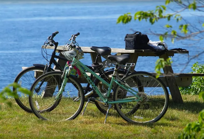
Vermont has many wonderful roads and trails for bicycle touring or mountain biking. Bikes are also a fun way to get around the parks and campgrounds. You can bike alongside relatively flat lakes and rivers or test your skills climbing a single track mountain trail.
Enjoy close views of farms and forests, mountains and lakes. Ride from your campsite down to the beach or to get some ice cream at the local store.
Top 5 Parks for Biking
Here are our picks for some of our favorite biking parks:
Button Bay State Park
When you think about Vermont, most people think about mountains. But the closer you get to Lake Champlain, the flatter the terrain becomes. And that, combined with panoramic views of the Adirondacks, Green Mountains and big lake, makes for some spectacular bike riding.
Button Bay State Park is on the Lake Champlain Bikeway, a 363-mile bike route around Lake Champlain and Richelieu River in Quebec. The primary route is mostly paved, and the entire system includes 992 miles of shorter themed loops. There is minimal traffic along most of them, and the section around Button Bay State Park is especially suited to family riding.
Nearby riding destinations include the Lake Champlain Maritime Museum, Basin Harbor Club and D.A.R. state park. The southern Lake Champlain region near Button Bay is rich in Revolutionary War history - you may wish to visit Chimney Point and Mount Independence Historic Sites, the Fort Ticonderoga National Historic Site, or the John Strong Mansion Museum during your stay.
Button Bay State Park has tent sites with wide open views of the lake, lean-to’s, a swimming pool and large open air picnic pavilion. The park is named for the button-shaped concretions, (geological formations) found in the sedimentary clay soil of the area. A gorgeous nature trail leads to the point where the nature center is located and nature programs are offered daily. Fishing and boating are also popular activities in this park.
Visit the Button Bay State Park page
Emerald Lake State Park
The rugged, steep mountains of southwestern Vermont are a northern extension of the Taconic mountain range, which begins along the western border of Connecticut and the eastern border of lower New York.
Once known for its slate and marble production, the geology of this region produces white-rocked cliffs, limestone caves and deep, emerald green lakes and quarries (thus the name Emerald Lake).
In southern Vermont, the Taconics are paralleled on the east by the southern end of the Green Mountains. Running between these formidable ranges is the lovely “Valley of Vermont”, where Otter Creek flows north to Lake Champlain, and the Battenkill River, renown for its trout fishing and canoeing and kayaking opportunity, flows south. The vales of the Battenkill, Otter Creek, and Mettawee River and the adjoining corridors of Routes 11, 30 and 7 make for some world class bike routes as well. These routes have spectacular scenery but are best suited for intermediate to advanced riders.
Emerald Lake State Park has tent and lean-to camping, a large beach, swimming, fishing, boat rentals, concession stand and hiking trails. The Green Mountain National Forest with its extensive network of trails and remote camping opportunities, the Appalachian Trial, the Battenkill River, the village of Manchester, and Equinox Mountain are all local attractions.
See also: Northshire Area Trails System
Visit Emerald Lake State Park page
Grand Isle State Park

The Champlain Islands, located between urban Montreal, Quebec and Burlington, VT retain a quiet rural charm. The landscape sports waterside farms, orchards, a vineyard and the longest sand beach in Vermont. Recreational opportunities such as swimming, fishing, paddling and biking abound.
In particular, the Champlain Islands are known for their many road biking options. The Lake Champlain Bikeways network includes over 992 miles of theme loops ranging in length from 10 to 60 miles along an array network of quiet country roads. Five loops in the Champlain Islands include “Island Life” (11.6 miles), “Stone Castles” (15.0 miles), “A Trail to Two Beaches” (17.5 miles), “Liquid Elixir” (11.7 miles), and “A legacy of Ancient Stone” (10.1 miles).
If you camp at Grand Isle State Park, you will also have free day access to Knight Point, Sand Bar, Alburgh Dunes and Sand Bar state parks, where swimming beaches, picnic, and parking facilities make great places to start, finish, or simply stop for a break when out on a ride.
See also: Lake Champlain Bikeways
Visit the Grand Isle State Park page
Lake Carmi State Park
On the shores Vermont’s fourth largest lake, Lake Carmi State Park is right in the middle of farm country. Quiet back roads take you past rural landscapes and generations-old family farms, quaint villages, rolling fields and forested woodlots.
The park is just a short ride from and fairly near the midpoint of the 26-mile Missisquoi Valley Rail Trail, which runs between the towns of St. Albans and Richford. The packed gravel surface of this old railroad grade makes for an easy ride, and the fact that you’re off the highway with no traffic to worry about makes it all the more enjoyable. Much of the trail follows the beautiful Missisquoi River, known for its spring whitewater, great fishing and downstream heron rookeries.
While you’re in the area, you might wish to visit the 6,600 acre Missisquoi National Wildlife Refuge, which provides an important stop over, breeding, and feeding area for migrant birds and waterfowl.
At Lake Carmi State Park, the paved campground roads are great for kids’ bike riding. There is a large day use beach, boat launch ramps, boat rentals, tent, lean-to, and cabin camping, plus daily nature programs. The state park is also the home of the third largest peat bog in Vermont- this natural area is a 140-acre tract of spongy sphagnum moss and unique bog flora.
See also:
Visit the Lake Carmi State Park page
Ricker Pond State Park
In the heart of the 26,000 acre Groton State Forest, Ricker Pond State Park was once the location of a working saw mill. The Montpelier-Wells River railroad ran through the park, and the former railroad bed is now part of the Cross-Vermont rail trail. When completed this will be a 75-mile bike trail between Burlington and Newbury. Ten miles of this trail run through the Groton Forest. With a packed gravel bed and average gradient of less than 2%, it is appropriate for family riding and is easily accessible for people with disabilities. The trail takes you in and out of woodlands and past secluded lakes. Family riders can do an easy out-and-back, where experienced cyclists may choose a day-long loop.
Ricker Pond has tent and lean-to camping, five cabins and a small, fully furnished cottage. Loons are common on this quiet pond. Your campsite registration gets you entry into all of the other Groton parks, too. With its vast network of trails, ponds, lakes, streams and forests, there are a variety of outdoor recreational opportunities to keep the whole family occupied.
Visit the Ricker Pond State Park page
Resources
- Cross Vermont Trail
- Cycle the City: Biking in Burlington
- Lake Champlain Bikeways: Addison, Rutland and Windsor Counties Maps and Guides
- Lake Champlain Bikeways: Champlain Islands Maps and Guides
- Lake Champlain Bikeways: Chittenden County Maps and Guides
- Lake Champlain Bikeways: Franklin County Maps and Guides
- The Island Line Trail: Burlington Bike Trail Map and Guide
- Vermont Rail Trail System
Bike Rental Fees Burton Island & Grand Isle Only
| Half Day (4 hours) | Full Day (24 hours) | Additional Day (24 hours) | |
|---|---|---|---|
| Bike Rentals | $15 + tax | $25 + tax | $15 + tax |
Mountain Biking
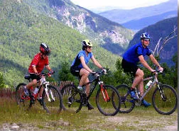
Mountain biking is a popular sport, and in Vermont we have a lot of mountains! If you are looking for some great rides, or are wondering about mountain biking on state land, here are some resources that can help you plan your trip:
Top Parks for Mountain Biking
Branbury State Park: Directly adjacent to the Green Mountain National Forest and the Moosalamoo National Recreation Area, with miles of new mountain bike trails in the forest. Access to trails is via the Green Mountain National Forest and forest roads directly to the east of the park. The GMNF website has more detailed maps and information.

Brighton State Park: Makes a great base for riding Kingdom Trails in East Burke, which attracts mountain bikers from all over the world. Only a half an hour away, this park is located in a beautiful, remote setting and rightfully popular with locals. Directions: From the town of Island Pond, East Burke/ Kingdom Trails is 20 miles south on VT-114. The Welcome Center is open 7 days during summer, parking is behind the Northeast Kingdom Country Store right in town.
Coolidge State Park: Easy access to many gravel roads and trails in Coolidge State Forest (PDF). Less than half hour to Okemo Mountain Resort's Evolution Bike Park.
Gifford Woods State Park: Also close to Coolidge State Forest, and only a short drive from Killington and the Killington Resort Bike Park. Nearby in Rutland, Pine Hill Park offers 16 miles of bike trails.
Jamaica State Park: A half hour drive from Mt. Snow's Bike Park in Dover.
Little River State Park: Over three miles of new trails recently opened in the park, and the Waterbury Area Trails Alliance maintains more trails nearby at Perry Hill. Directions: From the contact station at the park entrance, take a left and continue on the road towards the "B" camping area. Parking is at the Dalley Loops trailhead.
Molly Stark State Park: A half hour drive from Mt. Snow's Bike Park in Dover.
Groton State Forest: There are several parks located within the 26,000 acre Groton State Forest, which includes a network of over 60 miles of trails (PDF), many of which are multi-use trails and forest roads suitable for mountain biking.
Additional Mountain Biking Resources
- Coolidge Range Trail Map and Guide (PDF)
- Bomoseen and Half Moon Trails Guide (PDF)
- Lake St. Catherine Map & Guide (PDF)
- Groton State Forest Trail Map (PDF)
- Little River Area Map (PDF)
- Mt. Ascutney Recreational Guide (PDF)
- Kingdom Trails in East Burke
- Moosalamoo National Recreation Area
- Bennington Area Trail System
- Wilmington & Dover Valley Trail
- Hoot Toot and Whistle Bike Club
- Rules for Mountain Biking on State Lands (PDF)

